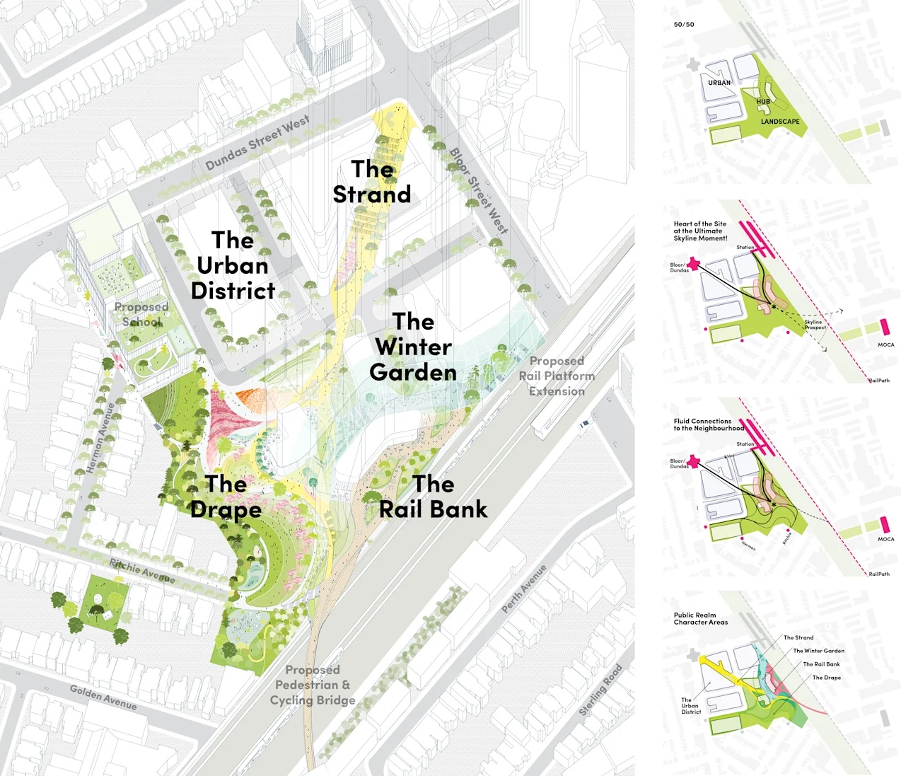
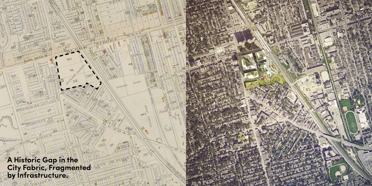
One of the largest undeveloped sites in Toronto, these 10 acres at the intersection of Bloor and Dundas are exceptionally well-connected via various modes of transit—TTC subway and streetcars, GO train, West Toronto Railpath (cycling), Bloor Street bike lanes, and, more uniquely, one of two UP Express stations between Union Station and Pearson Airport.
The site occupies the center of an as-yet unnamed triangular swath between the Junction Triangle, Roncesvalles Village, and High Park. It ostensibly lacks a neighbourhood identity, but a closer look at the built fabric of this swath reveals a pattern of unusual spatial and programmatic anomalies that tend to emerge when a major natural or infrastructural element disrupts the city grid. This diversity of form has led to a a diversity of uses as irregular little splices and patchworks of industry, have evolved to become eclectic collections of creative uses.
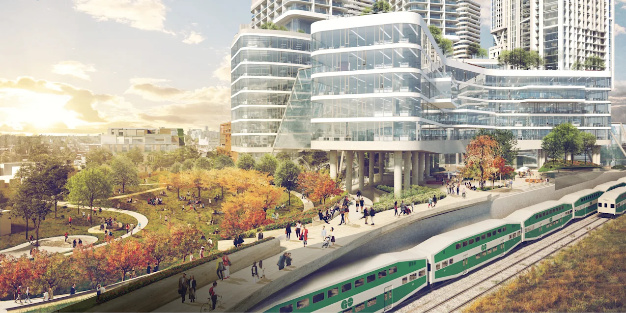
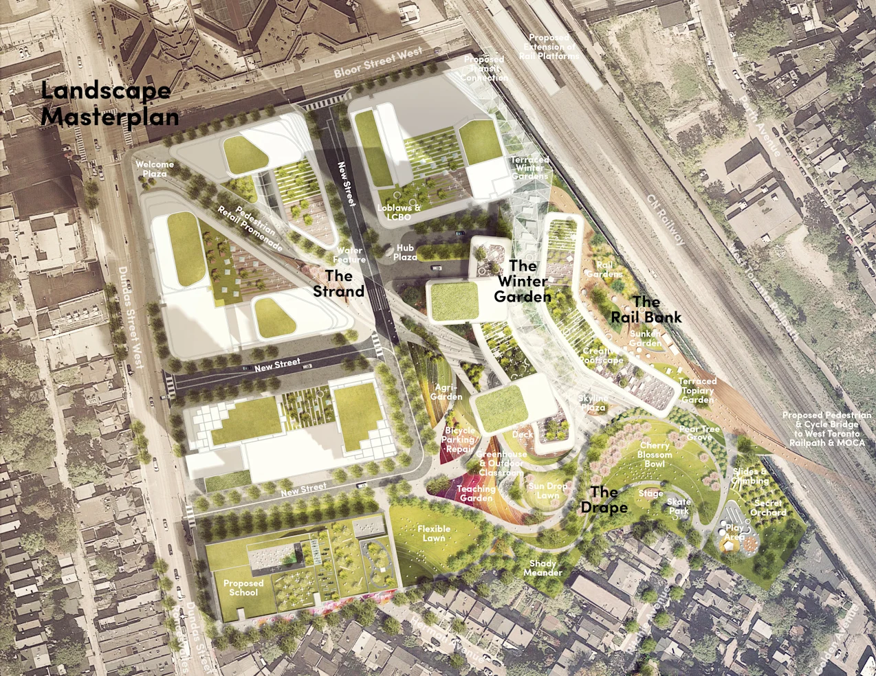
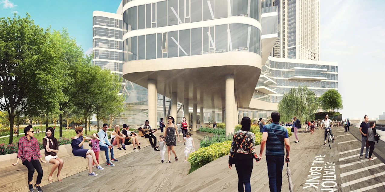
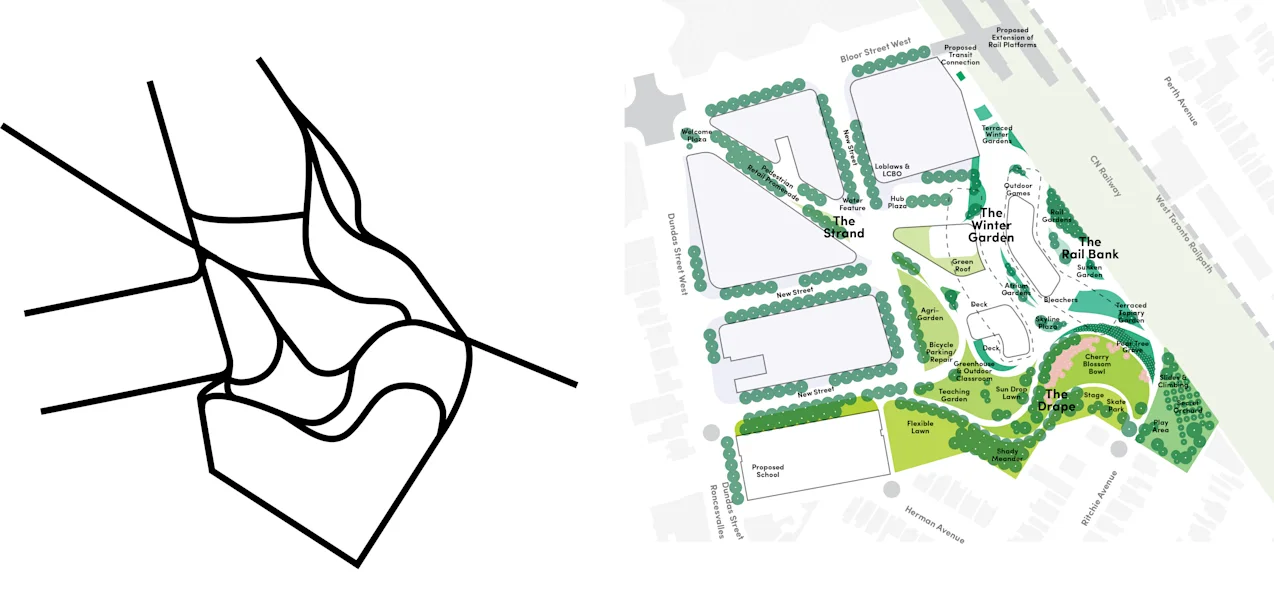
What if instead of treating this major rail corridor as a negative, with buildings and neighbourhoods turning their backs to it, we treat it like an inherent asset, a valuable frontage for addresses, recreation, and city life?
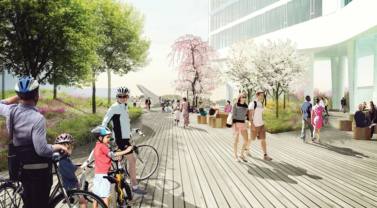
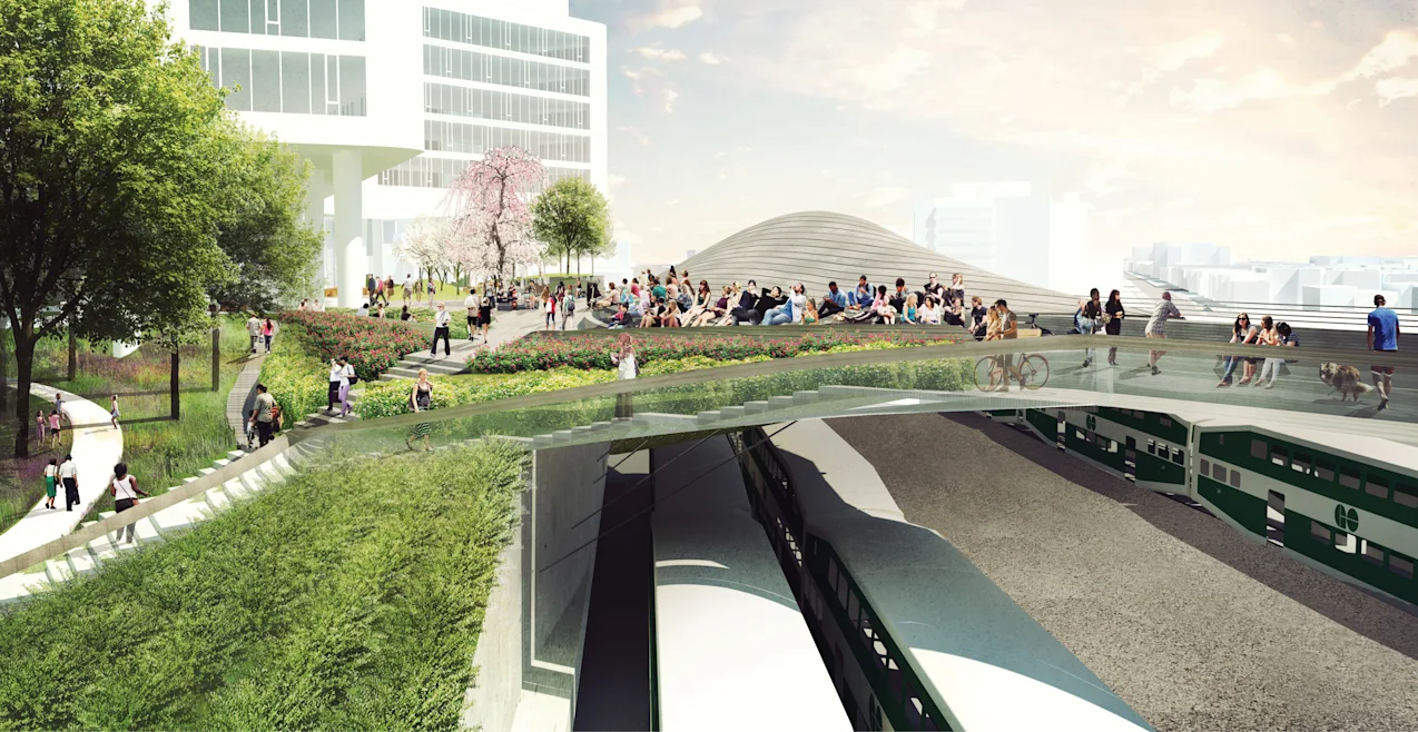
The guidelines that govern construction along rail prescribe large setbacks for residential use, but we see those setbacks as an opportunity for diverse, public-facing, non-residential uses. A narrow, multi-layered, mixed-use strip could occupy the long linear gap between the residential towers and the rail, topped by an elevated public promenade along the rail corridor. Its north end functions as a multi-modal station, stitching into all nearby transit (cycling, train, subway, street car, and pedestrian) routes, while its south end widens and spills into a large proposed park along the southern boundary of the site. In Europe, a riverbank invites promenades, vistas, active urban life; here, with unencumbered views of Toronto’s skyline, why not a railbank?