[Detail Design]
To serve both of these important roles, Creek Park is designed as a public space for both the Fort and for the City—activating our collective memory of the past and the evolving, expanding needs of the community. The public space design and its programming therefore balance the recognition of this remarkable historic place with the local need for new community uses.
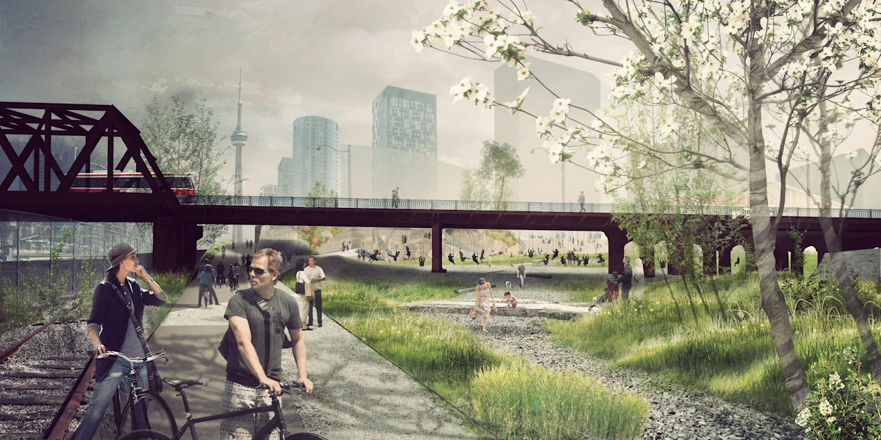
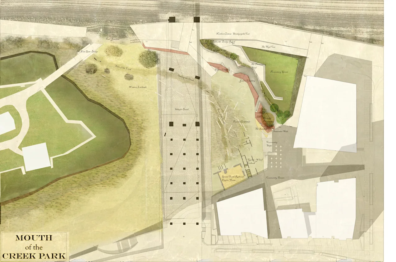
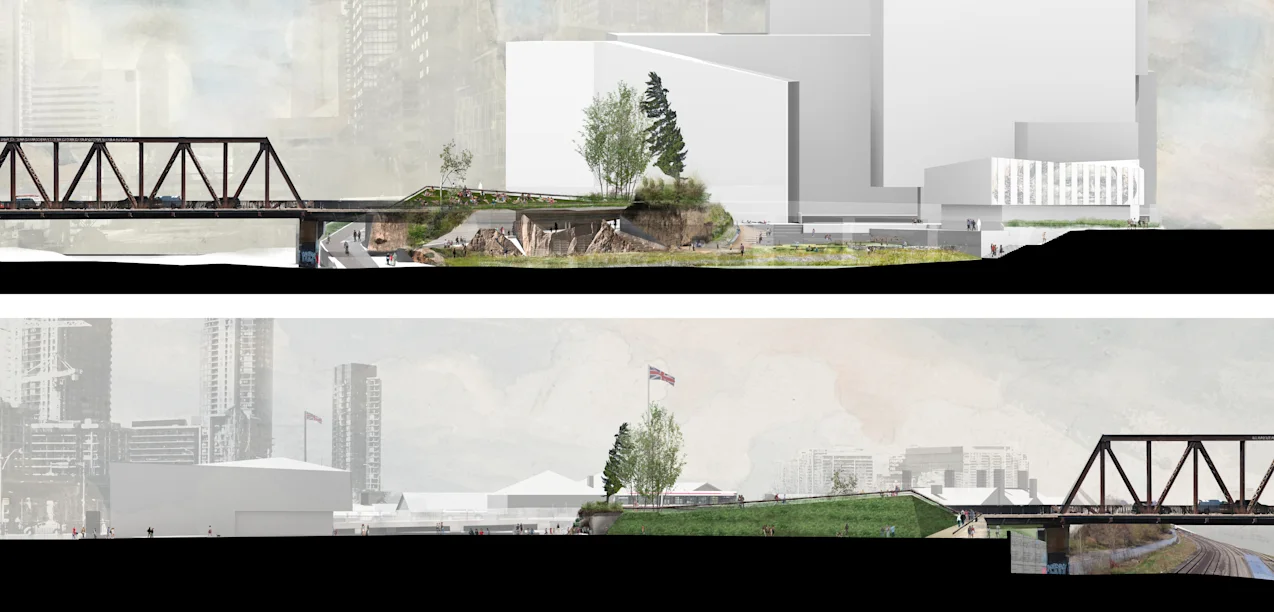
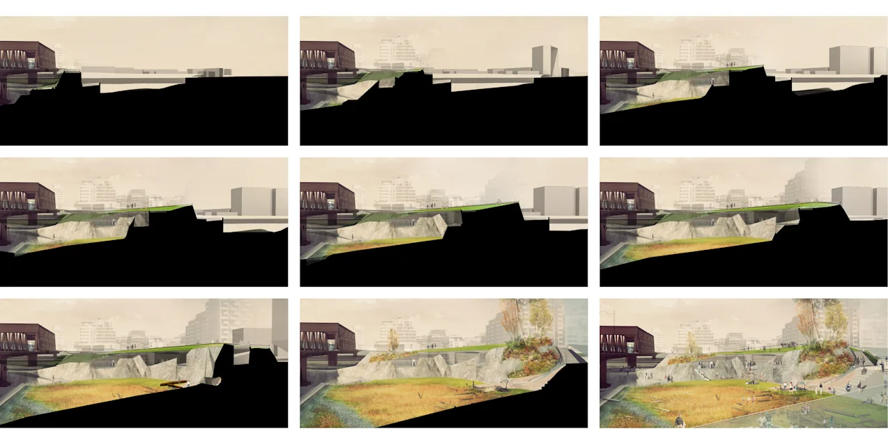
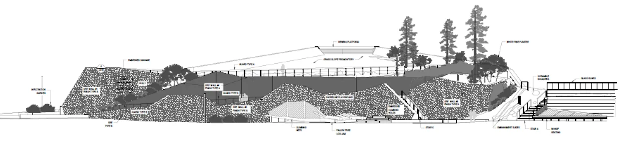
The design strategically uses the site’s sloping terrain to re-shape a promontory landform—a feature of Toronto’s original shoreline—for multi-purpose activities. The constructed promontory maximizes function by lifting almost half of the small 2-acre park space out of the shadow of the Bathurst Street bridge and the steadily densifying city.
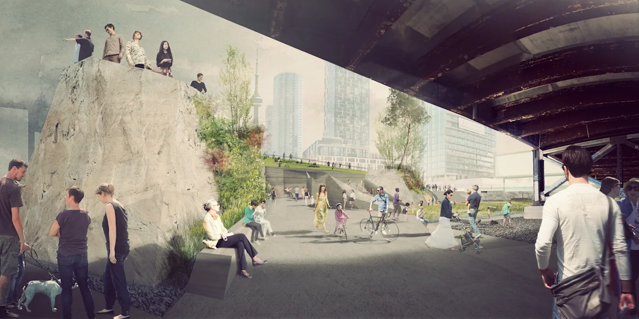
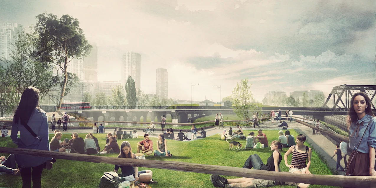
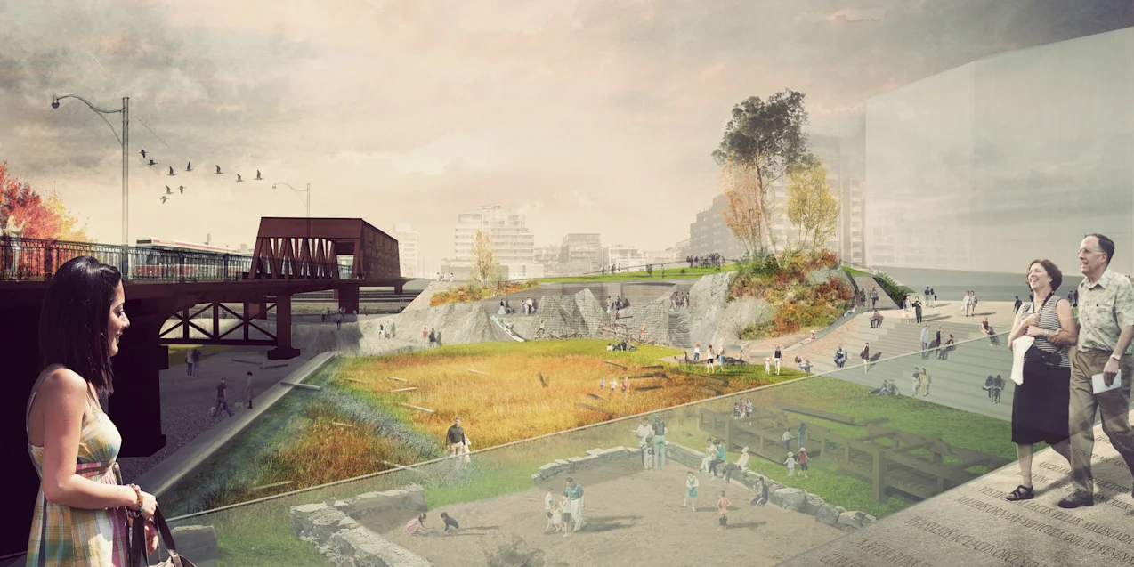
Manipulation of the site’s terrain creates three distinct landscapes each supporting different visitor experiences and vegetative communities. The ‘high and dry’ Panorama Lookout offers a living history of Toronto as visitors take in the full historic vantage point of the Fort and the lake against the contrast of the evolving cityscape. The Garrison Lowlands bring back the presence of the creek itself through marsh-like vegetation, a limestone shingle beach, and key archeological remnants which are resurrected as children’s play structures. The embankment, which connects the upper and lower areas of the park allows visitors to come face to face with a dramatic landscape feature that recalls the original shoreline.
Although the park is small, it plays a critical connective function within the existing green network of the city. The design of the park takes advantage of this potential to create a legible and accessible network of green spaces as it connects the neighborhoods east and west of the site, links the new library and its programming to Fort York, makes cycle and recreation path connections, and opens up the space under Bathurst Bridge as a positive passage and clearly defined access point for the park.