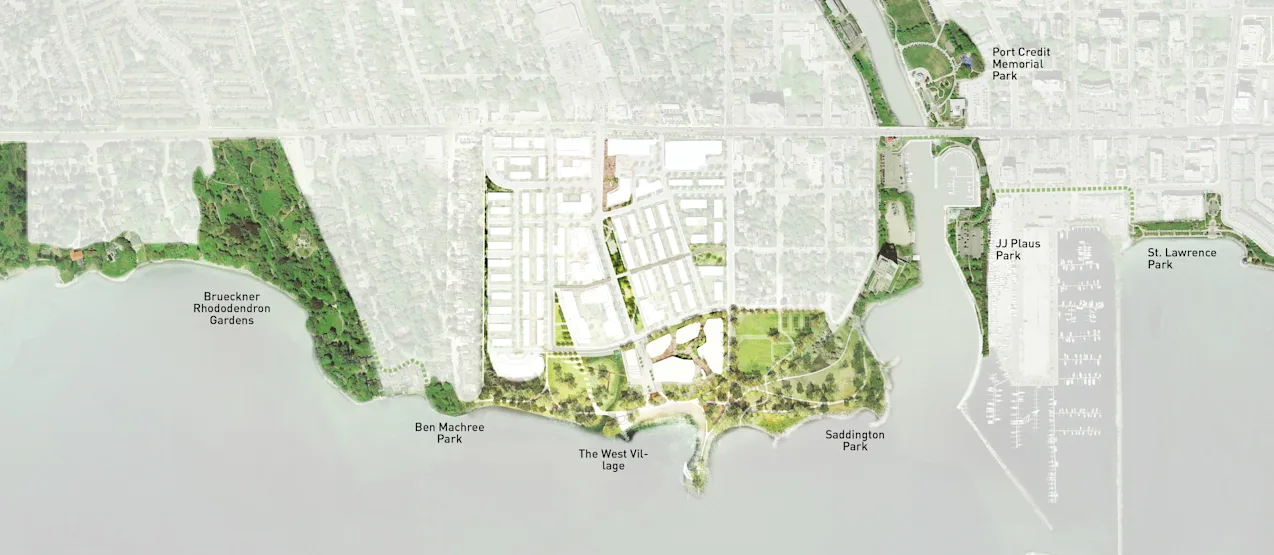
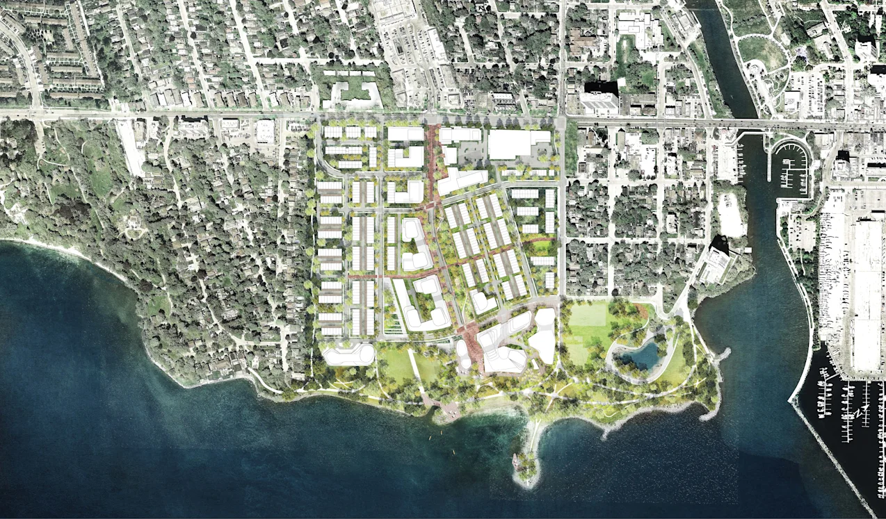
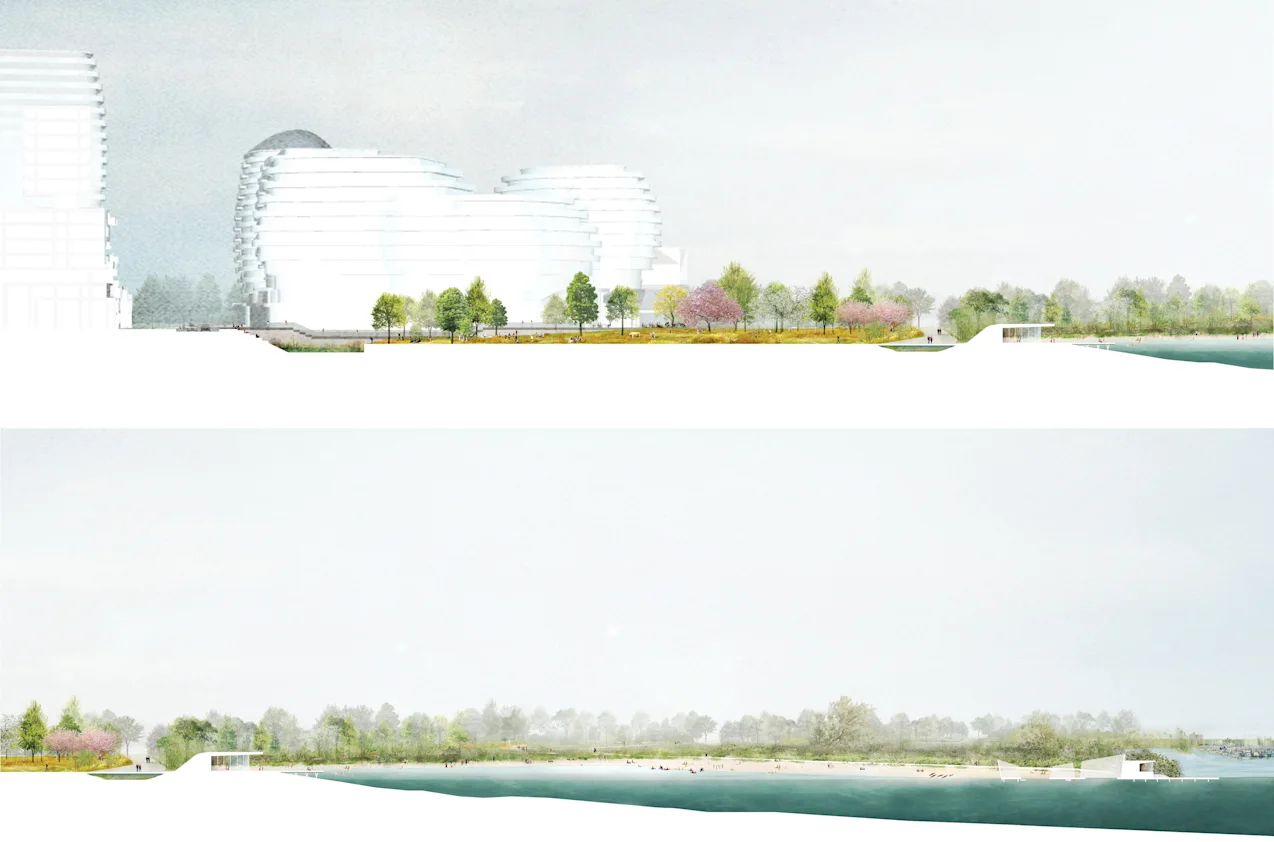
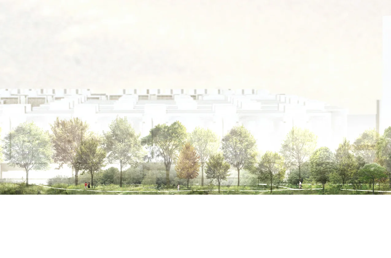
The project starts with realizing and defining the identity of the West Village as complimentary, yet distinctively different, to that of Port Credit itself. Whereas Port Credit evolved from the industrialized or recreational port, the West Village considers the legacy landscape of the Credit River to inspire the design of a new kind of community with a more meaningful relationship to its unique river mouth location. Through the last 100 years of subdivision and settlement of the land, the river bank and shoreline condition have been condensed and compromised, a far cry from the former tributaries, marshes and diverse ecologies that populated the lake and river front. The district vision aims to re-establish an expanded shoreline experience that penetrates deeper into the neighbourhood, showcasing and celebrating the flow of water back to the lake via a reimagined and re-naturalized shoreline park.
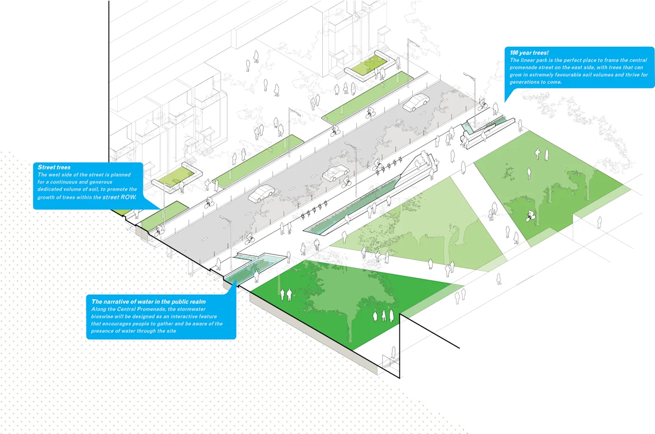
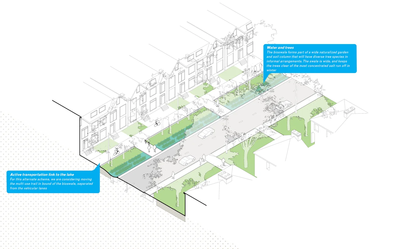
Working with a team of ecological, remediation, habitat and engineering specialists, PUBLIC WORK has designed a series of connected parks, open spaces and unique streetscapes that promote sustainable storm water practices, habitat restoration and dynamic ecologies, while supporting a vibrant public realm within a walkable and bikeable community. Streets are designed to have all water run off visible within the municipal right of way, promoting an awareness of precipitation and water quality, and encouraging more diverse streetscape plant ecologies. All features are designed to be interactive experiences, with distinct designs specific to their role within the broader circulation plan. For the park system, broader patterns of overland flow are reflected in the topography of the land, which in turn are combined with programmatic elements to enrich the park experience for all users, with an emphasis on broadening opportunities for children to interact with nature in the urban environment.